Difficulty distribution
How the classified questions are distributed by difficulty.
Your cart is empty.
Practice Basic Image Classification and Segmentation - Image Processing and Analysis - Geomatics Engineering previous year questions organised from real papers, with year-wise coverage and clear topic navigation.
Every graph below is calculated only from this selection.
Compare question counts across years.
How the classified questions are distributed by difficulty.
MCQ, numerical, multiple-select and other formats found in these papers.
Top subjects by unique question coverage.
Top topics across the included previous year papers.
Top subtopics inside this exact selection.
Question coverage for the most populated papers. Every active PYP paper remains listed below.
Newest papers appear first. Search these papers or sort by year and name.
| Paper name | Year | Attempt | |
|---|---|---|---|
Geomatics Engineering (GE) 20262026 | 2026 |
|
|
Geomatics Engineering (GE) 20252025 | 2025 | |
|
Geomatics Engineering (GE) 20242024 | 2024 | |
|
Geomatics Engineering (GE) 20232023 | 2023 | |
|
Geomatics Engineering (GE) 20222022 | 2022 | |
|
Practice every matching question in batches of 20, with every available option.
Which of the following statements is/are CORRECT for satellite image interpretation?
Which of the following CANNOT be used as visual interpretation key(s) for satellite images?
In the context of satellite image classification, which of the following statements is/are CORRECT?
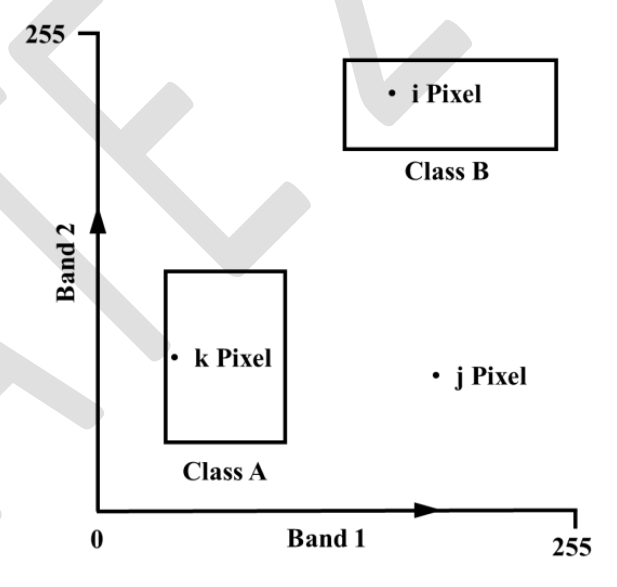
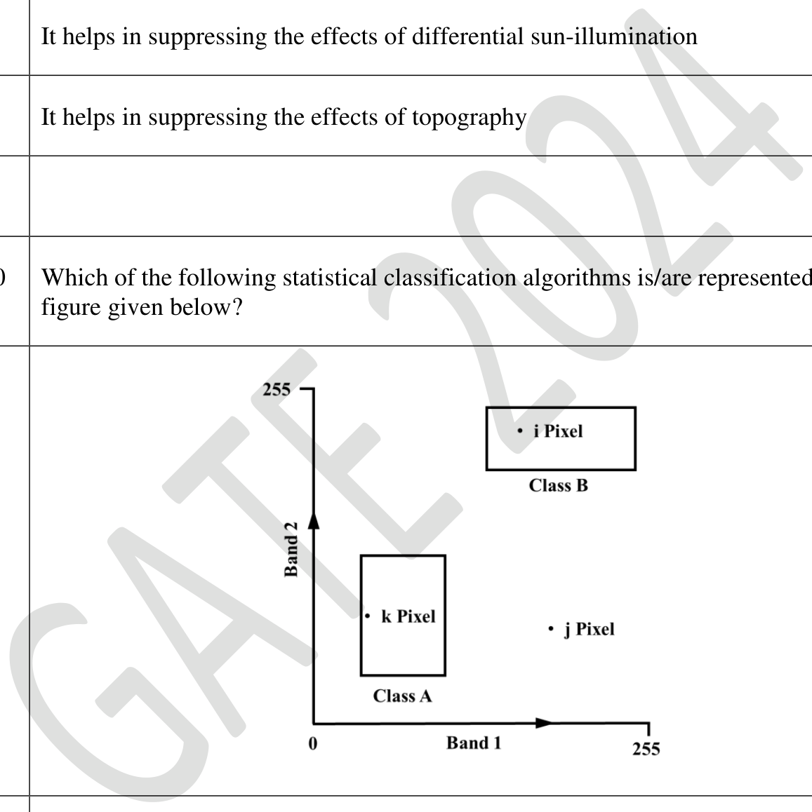
Which of the following statistical classification algorithms is/are represented by the figure given below?